Advertisement
These segments are often steep and challenging, and they allow users to compete against each other for the fastest time up the climb.
A Strava hill segment is defined by its start and end points, which are typically located at the bottom and top of a hill. The segment may be named after the hill or include a description of the terrain, such as "Miser Road Hill N-S, Black River" or "Lawton Road Climb".
When an athlete completes a Strava hill segment, their time is recorded and added to a leaderboard, which ranks athletes based on their performance on that segment. The leaderboard shows the fastest times for the segment, as well as other details such as the athlete's average speed, elevation gain, and power output (if using a power meter).
Hill segments can be challenging and rewarding for athletes who enjoy pushing themselves on steep climbs.
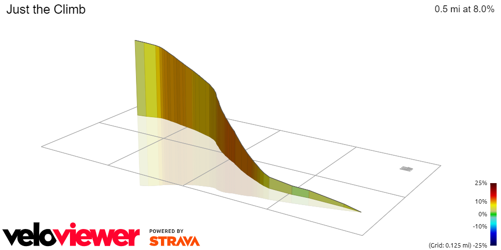
Distance - 0.48mi
Elevation Gain - 205ft
Avg Grade - 8.0%
*Maximum Grade - 11.5%


Strava Climb Category - 4
Distance - 0.68mi
Elevation Gain - 301ft
Avg Grade - 8.0%
*Maximum Grade - 14.9%
Strava Climb Category - 4
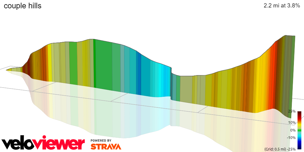
Distance - 2.16mi
Elevation Gain - 591ft
Avg Grade - 3.8%
*Maximum Grade - 14%
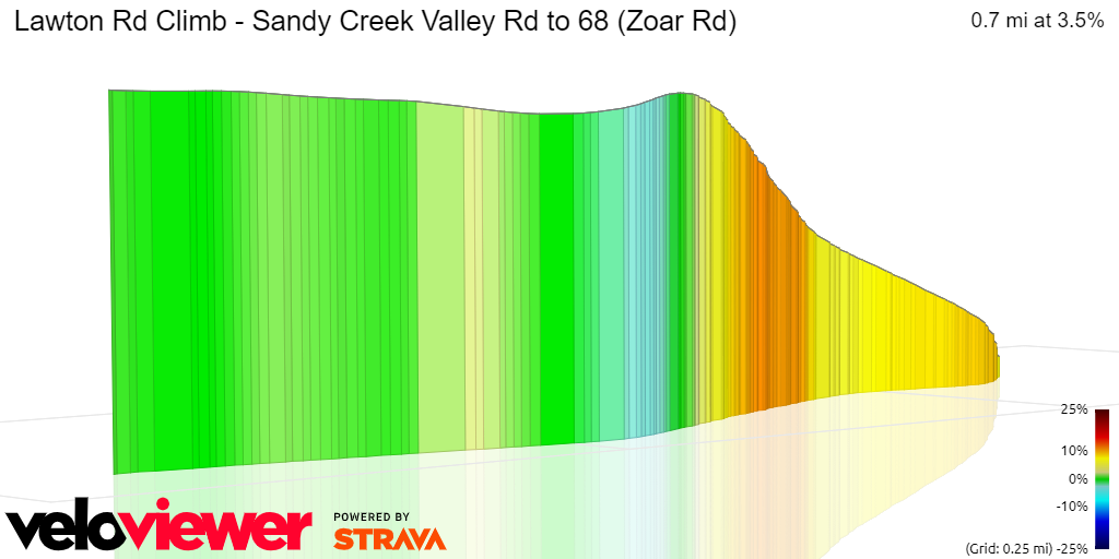
Distance - 0.69mi
Elevation Gain - 149ft
Avg Grade - 3.5%
*Maximum Grade - 10.7%
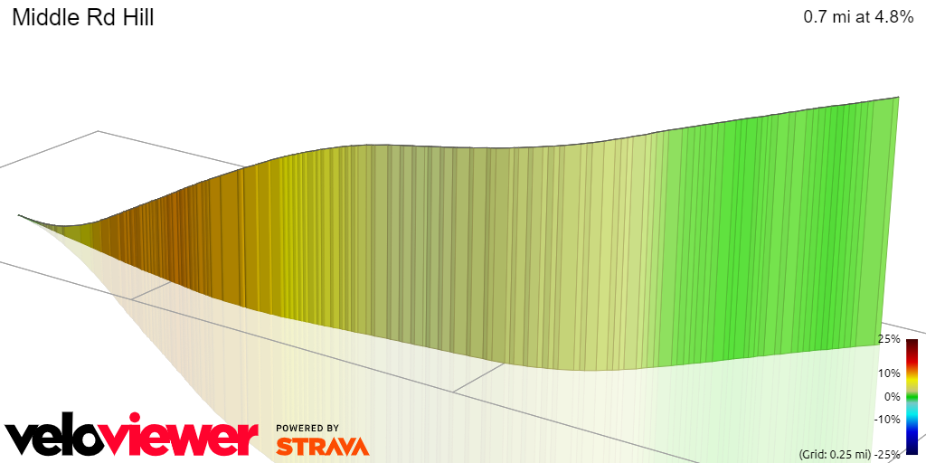
Distance - 0.66mi
Elevation Gain - 168ft
Avg Grade - 4.8%
*Maximum Grade - 10.5%

Strava Category 4 climb
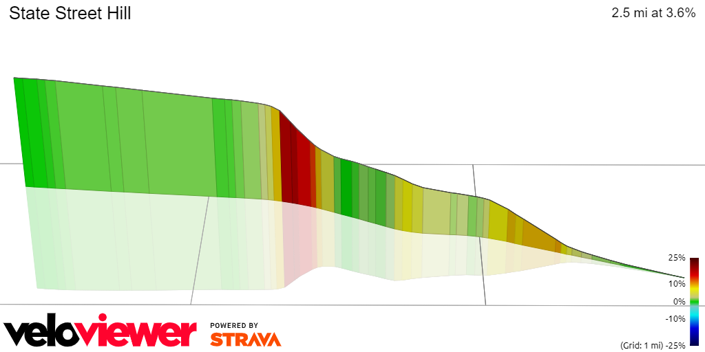
Distance - 2.51mi
Elevation Gain - 483ft
Avg Grade - 3.6%
*Maximum Grade - 22.6%

Distance - 0.22mi
Elevation Gain - 129ft
Avg Grade - 10.9%
*Maximum Grade - 21.8%

Strava Climb Category - 4
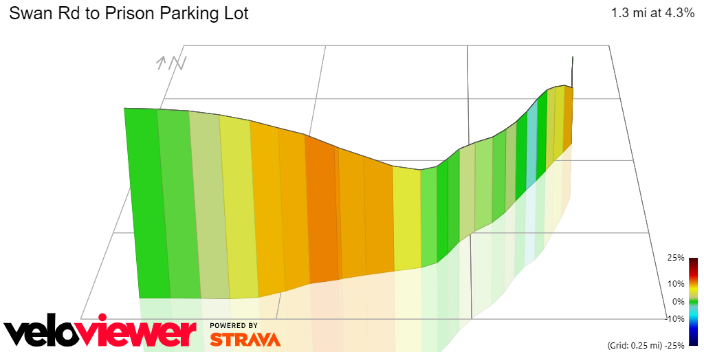
Distance - 1.41mi
Elevation Gain - 312ft
Avg Grade - 4.2%
*Maximum Grade - 15.2%
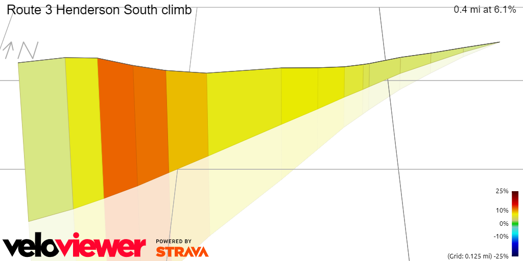
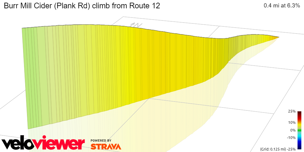
Distance - 0.37mi
Elevation Gain - 119ft
Avg Grade - 6.1%
*Maximum Grade - 11.8%

Strava Climb Category - 4
Distance - 1.71mi
Elevation Gain - 353ft
Avg Grade - 3.9%
*Maximum Grade - 11.5%
Strava Climb Category - 4
Distance - 1.25mi
Elevation Gain - 296ft
Avg Grade - 4.3%
*Maximum Grade - 13%

Distance - 0.55mi
Elevation Gain - 115ft
Avg Grade - 3.9%
*Maximum Grade - 7.6%

Distance - 0.28mi
Elevation Gain - 100ft
Avg Grade - 6.6%
*Maximum Grade - 8.9%

Distance - 0.47mi
Elevation Gain - 134ft
Avg Grade - 5.3%
*Maximum Grade - 19.9%
(Unfortunately there is an issue with the elevation/grade data which shows an incorrect spike near the top.)
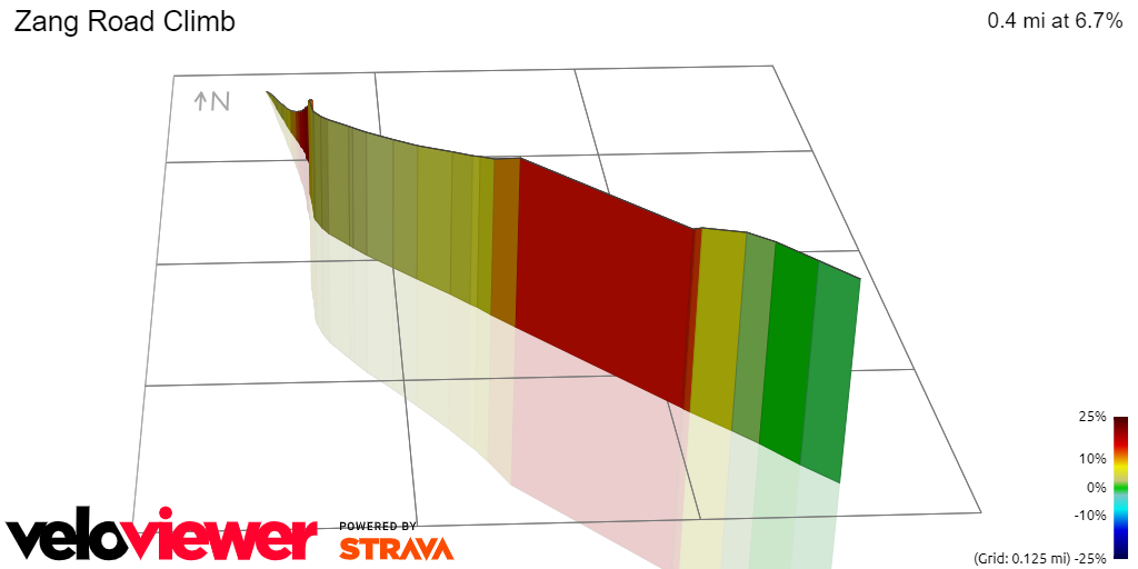
Distance - 0.43mi
Elevation Gain - 156ft
Avg Grade - 6.7%
*Maximum Grade - 17.6%

Distance - 0.95mi
Elevation Gain - 207ft
Avg Grade - 2.9%
*Maximum Grade - 13.6%

Strava Climb Category - 4
Distance - 1.71mi
Elevation Gain - 383ft
Avg Grade - 4.1%
*Maximum Grade - 13.9%

Strava Climb Category - 4
Distance - 1.21mi
Elevation Gain - 283ft
Avg Grade - 4.4%
*Maximum Grade - 11.4%

Distance - 0.50mi
Elevation Gain - 107ft
Avg Grade - 4.1%
*Maximum Grade - 7.9%

Distance - 0.31mi
Elevation Gain - 72ft
Avg Grade - 4.3%
*Maximum Grade - 10.8%

Distance - 0.26mi
Elevation Gain - 81ft
Avg Grade - 5.9%
*Maximum Grade - 11.9%
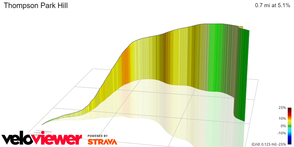
Distance - 0.68mi
Elevation Gain - 187ft
Avg Grade - 5.1%
*Maximum Grade - 5.1%

Distance - 0.43mi
Elevation Gain - 140ft
Avg Grade - 6.1%
*Maximum Grade - 8.3%

Distance - 2.75mi
Elevation Gain - 442ft
Avg Grade - 1.1%
*Maximum Grade - 11.3%
Strava Climb Category - 4
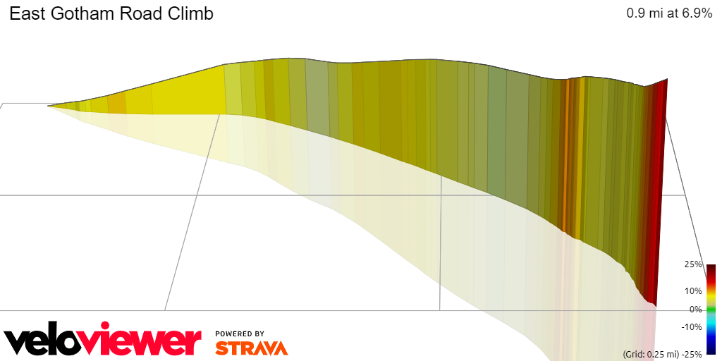
Distance - 0.88mi
Elevation Gain - 323ft
Avg Grade - 6.9%
*Maximum Grade - 15.6%
Distance - 0.38mi
Elevation Gain - 125ft
Avg Grade - 6.2%
*Maximum Grade - 8.9%

Distance - 0.72mi
Elevation Gain - 170ft
Avg Grade - 4.5%
*Maximum Grade - 10.1%

Distance - 1.26 mi
Elevation Gain - 335 ft
Avg Grade - 3.9%
*Maximum Grade - 16.3%
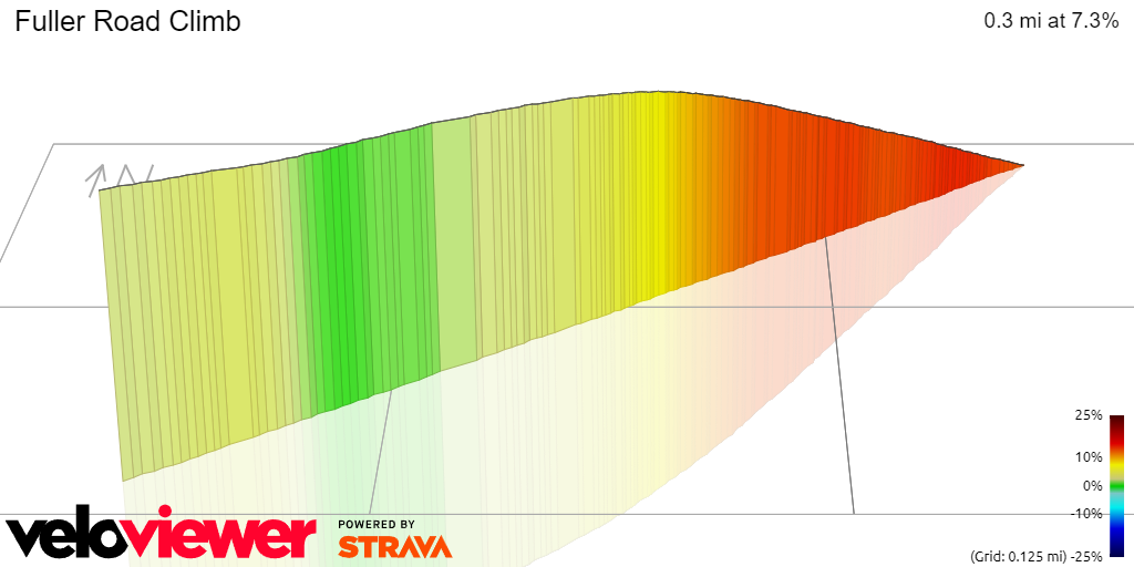
Distance - .33 mi
Elevation Gain - 130 ft
Avg Grade - 7.3%
*Max Grade - 16.7%


